
HERMESYS SOLUTIONS
As the spatial geography information technology evolves,
HermeSys is developing technologies that respond to the requirements of the rapidly changing GIS market.
Hermesys are assessing the characteristics of business in various fields
and developing and supplying optimal solutions that meet the professionalism in this field.
Solution
-
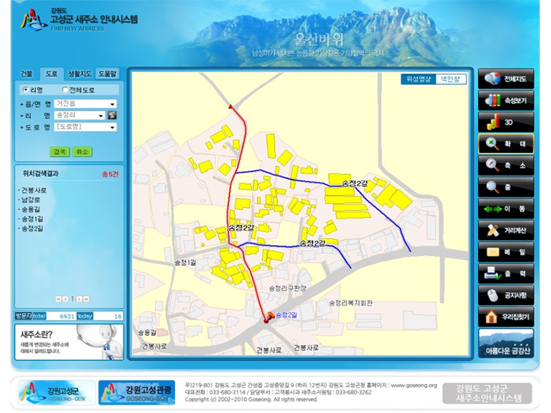 Guidance System for Road Name Address(WEB)
$4.59- $4.59
-
- ~
-
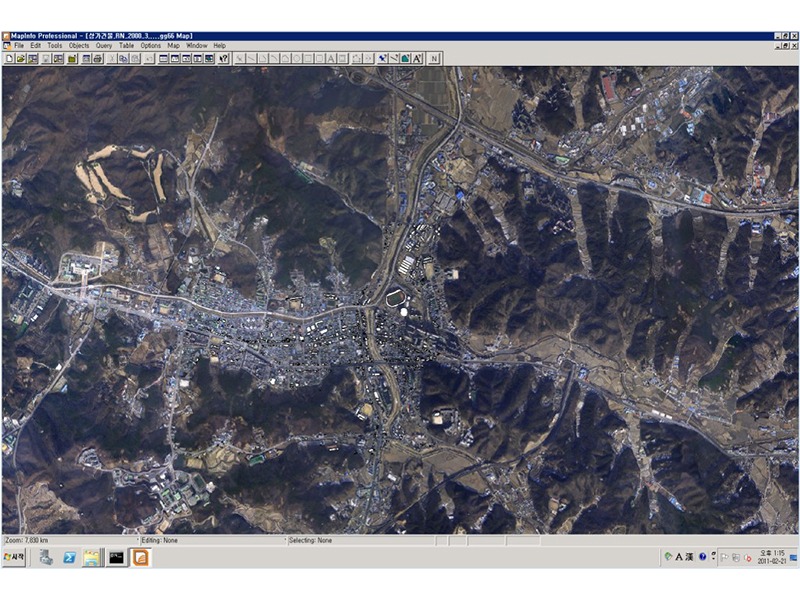
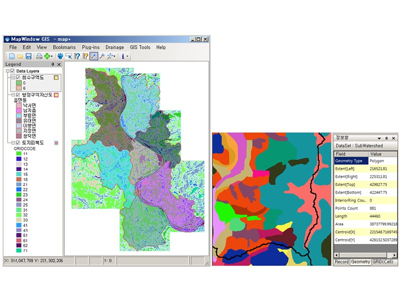
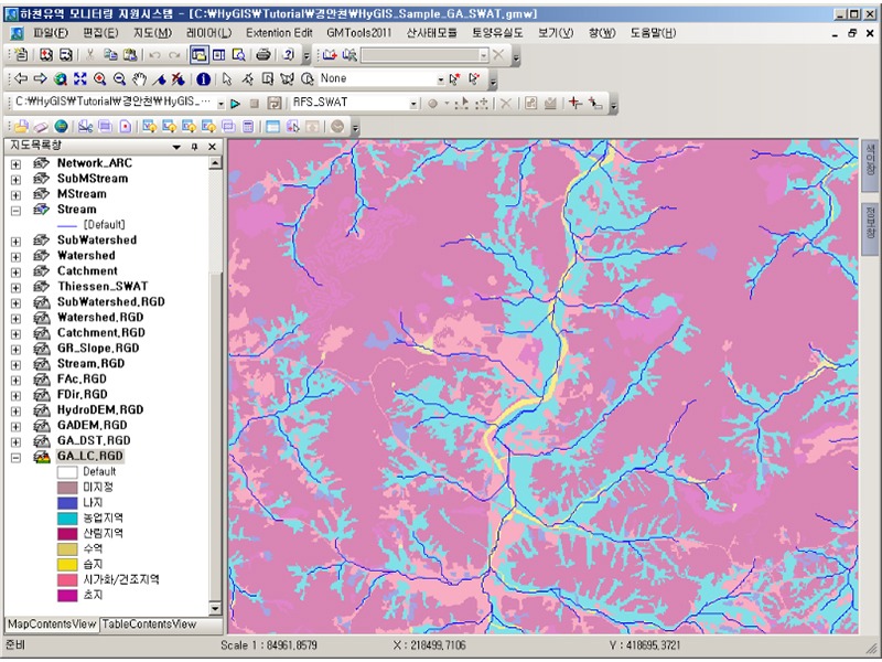 Water Resources GIS S/W (HyGIS)
$9.19- $9.19
-
- ~
-
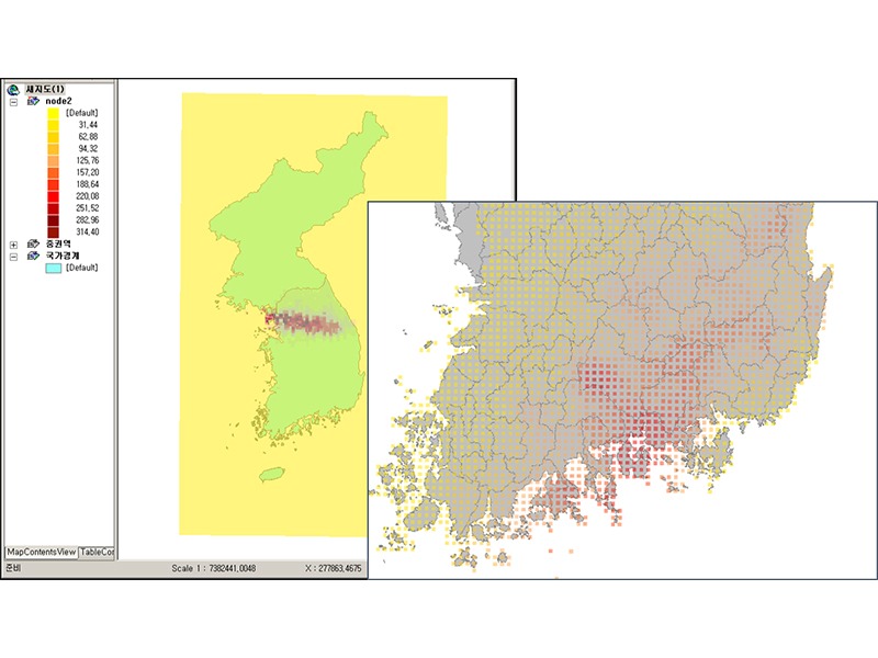 KMA (Korea Meteorological Agency)'s Weather Forecasts on Villages: Data Processing Technology
$4.59- $4.59
-
- ~
-
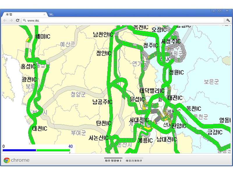 ITS Communication (Sensor) Information, GIS Processing Technology
$9.19- $9.19
-
- ~
-
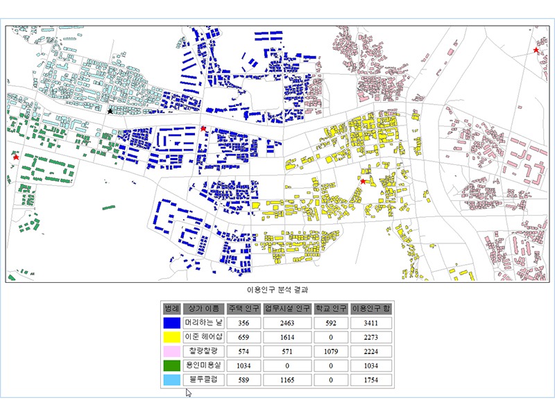 HermeSys/WMS-Based WEB Commercial Area Analysis System
$9.19- $9.19
-
- ~
-
 Development of RS Image Data (Layer) Utilization Technology Using OpenAPI
$4.59- $4.59
-
- ~
-
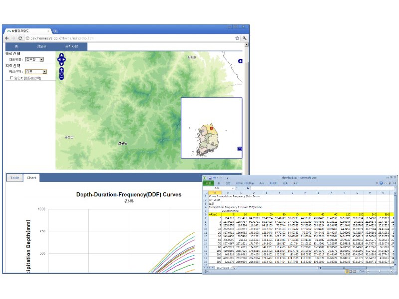 HermeSys/WMS-Based Precipitation Frequency utilization system
$9.19- $9.19
-
- ~
-
 Sewage Register Computerization Out of Yangpyung County's Main Sewerage Area Maintenance Project (Building system and data )
$4.59- $4.59
-
- ~
-
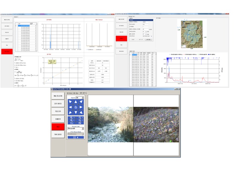 Monitoring River and Basin Project - Real-Time Sensing and Comparative Analysis
$9.19- $9.19
-
- ~
-
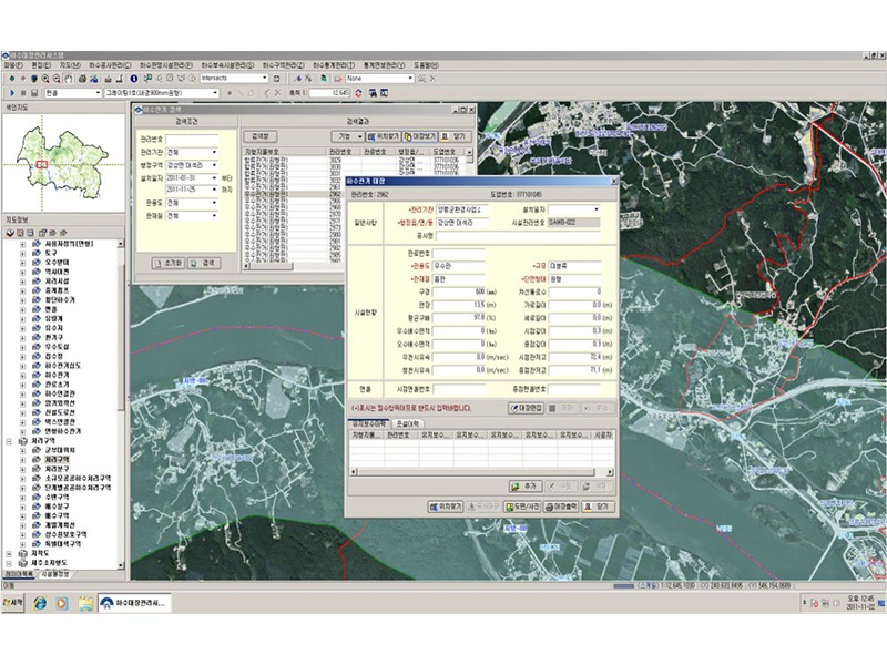
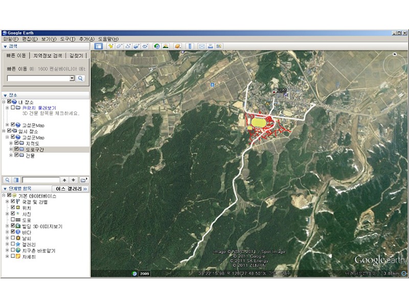
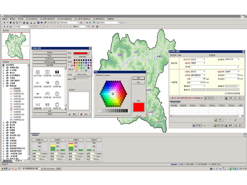 Jungsun County's Water Pipe Network Management System (Building system and data)
$9.19- $9.19
-
- ~
-
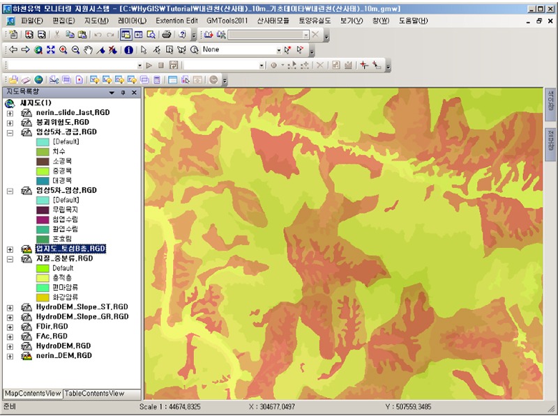 Monitoring River and Basin Project - Analysis of Landslide Hazard
$9.19- $9.19
-
- ~
-
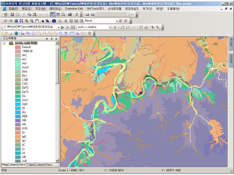 Monitoring River and Basin Project - Soil Loss Analysis
$9.19- $9.19
-
- ~
-
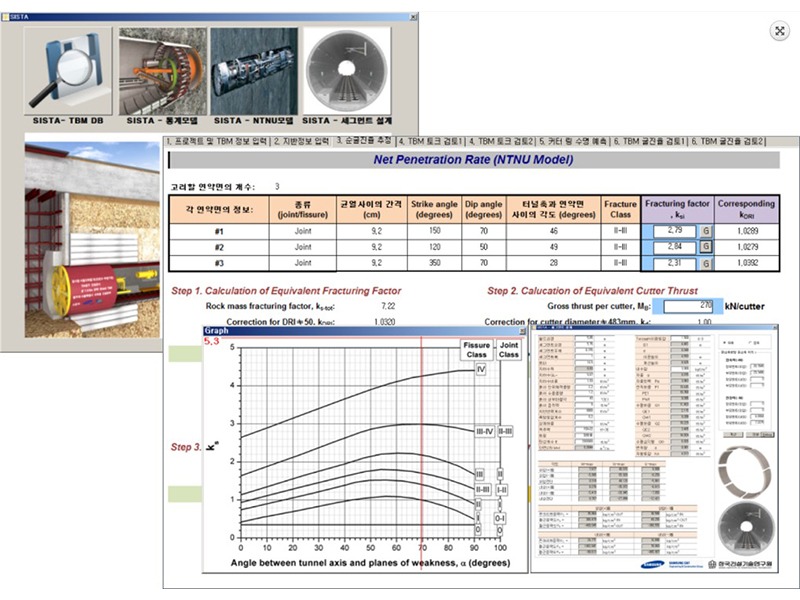 KICT's TBM Analysis Application SW Area Consulting (Technical)
$9.19- $9.19
-
- ~
-
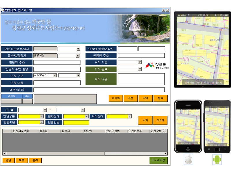 Jungsun County's Management and Operation Support System of Information on Civil Affairs for Water Pipe Network
$9.19- $9.19
-
- ~
-
 Mutual Operation and Convergence Processing Technology of Google OpenAPI + User GIS DB
$9.19- $9.19
-
- ~
-
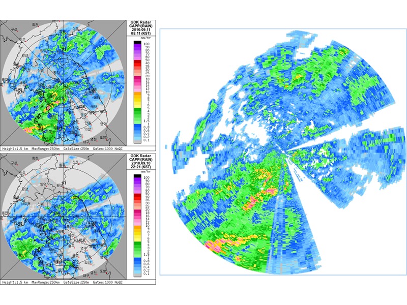 KMA's radar rainfall (Universal Format Data) Processing Technology
$9.19- $9.19
-
- ~
-
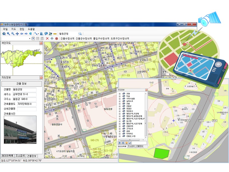 Site Management and Location Guidance System of New Address Data
$9.19- $9.19
-
- ~
-
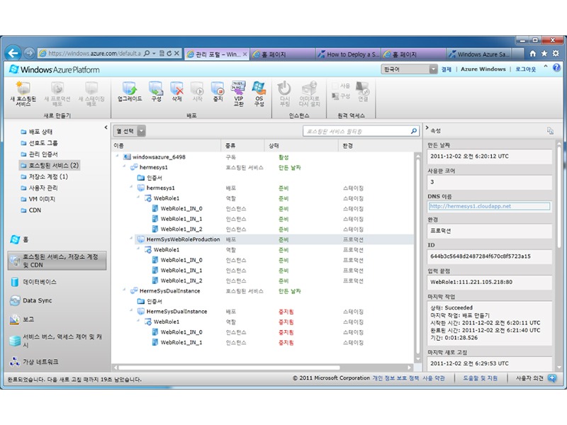 HermeSys Cloud Computing - with the MS Windows Azure Platform
$9.19- $9.19
-
- ~
-
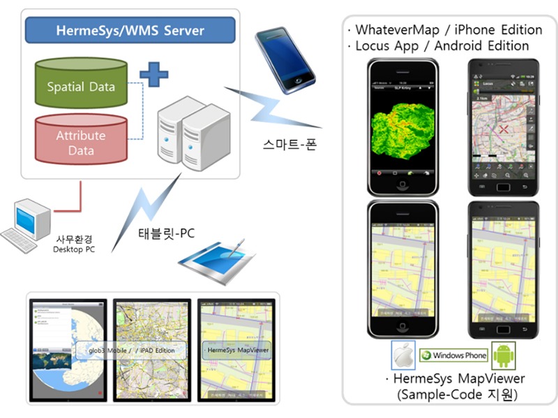 Smart GIS Solution that can operate and manage GIS information anytime and anywhere – HermeSys WMS
$9.19- $9.19
-
- ~
-
 GIS-Based Economic Analysis for Flood Control (Estimation of Water Flooding Rates under the MDF-FDA system)
$9.19- $9.19
-
- ~
-
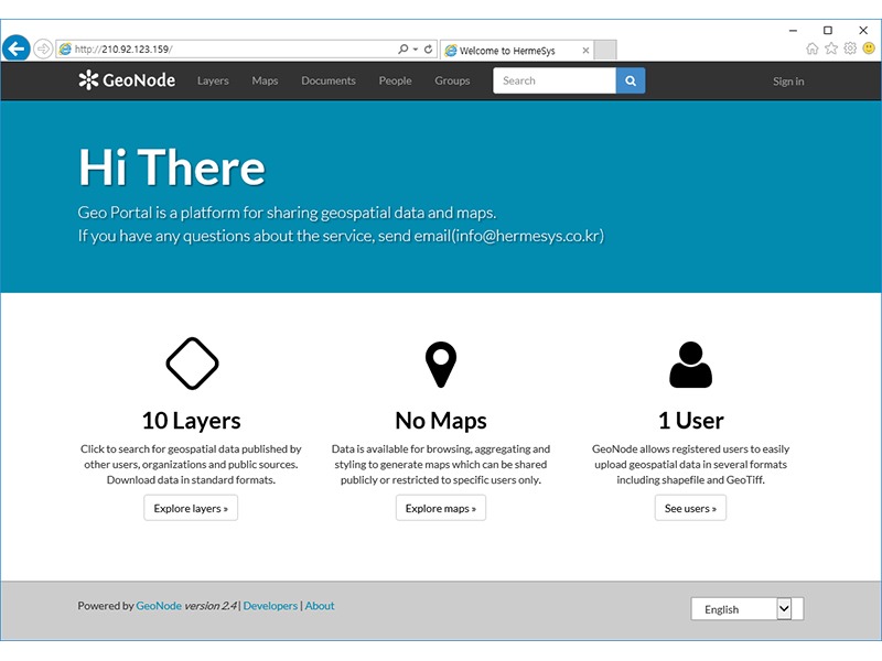 Spatial Portal Site
$9.19- $9.19
-
- ~
-
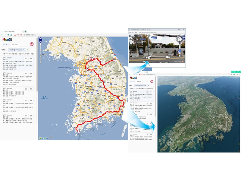 Best Path to Travel Web Application
$9.19- $9.19
-
- ~
-
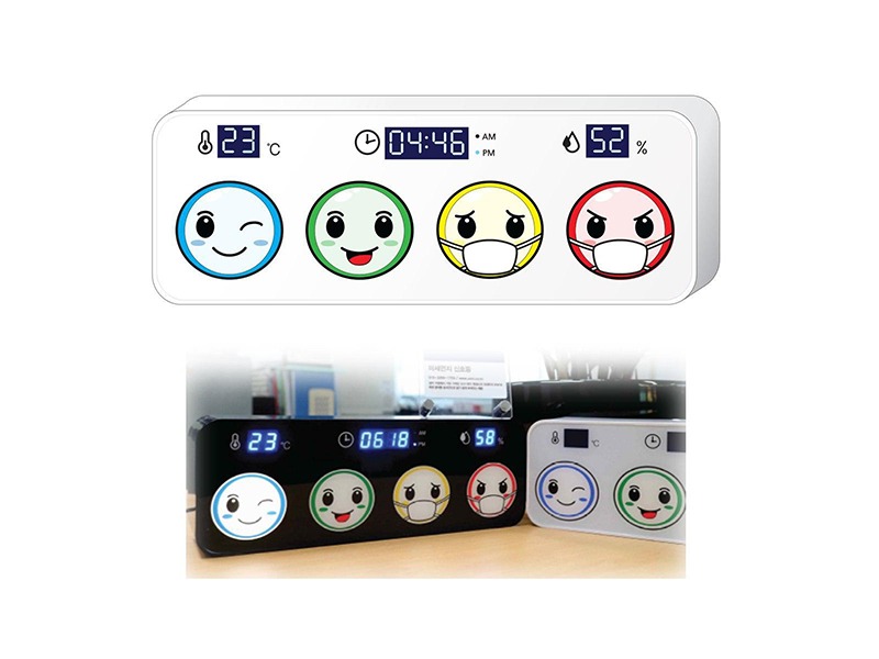 Fine dust signal lamp in four colors, using information from the Nearest Sensor
$9.19- $9.19
-
- ~
-
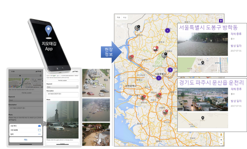 Geotagging System
$9.19- $9.19
-
- ~
-
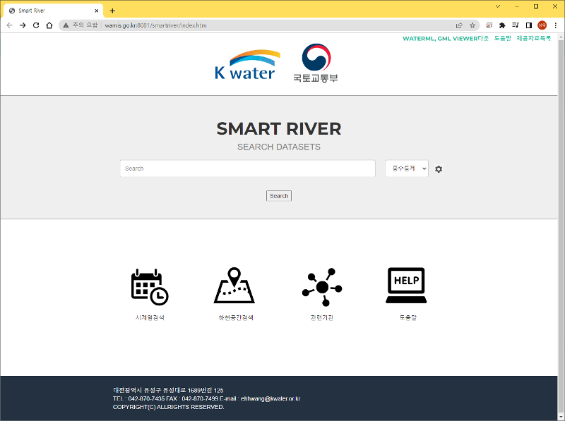 스마트리버 Portal
$0- $10.00
-
- ~
-
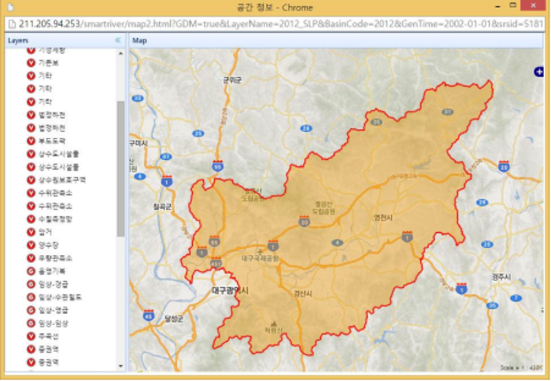 스마트리버 자료 조회
$0- $9.19
-
- ~
-
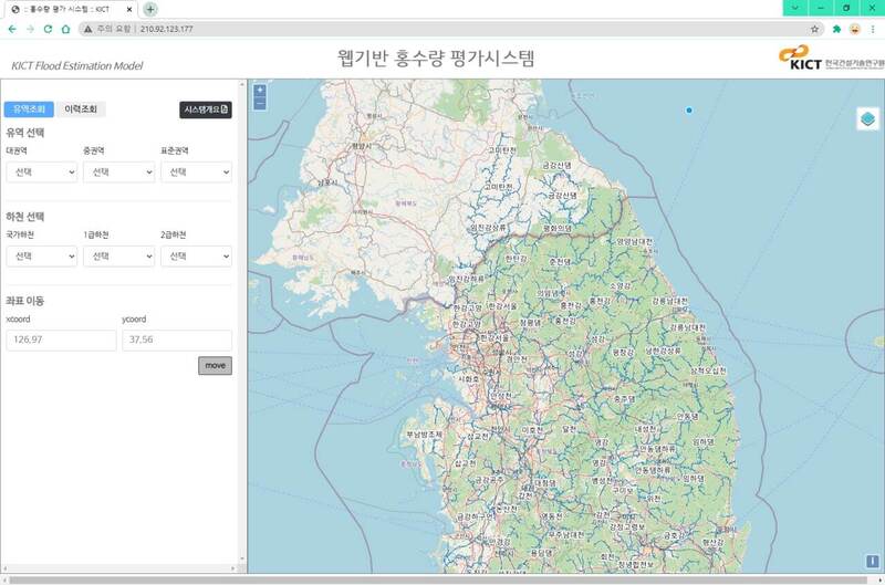 KICT 웹기반 홍수량 평가시스템
$0- $9.19
-
- ~
-
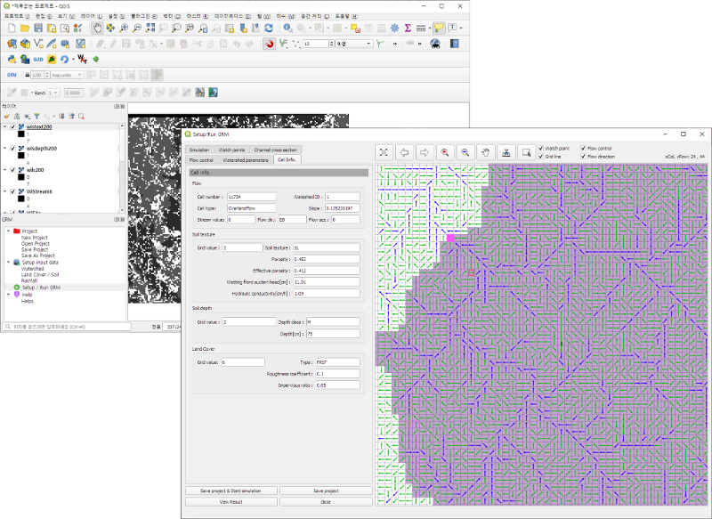 QGIS-GRM 분포형 강우유출모형
$0- $9.19
-
- ~
-
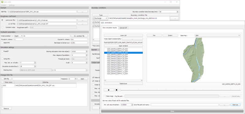 QGIS-G2D 격자방식 범람모델
$0- $9.19
-
- ~
-
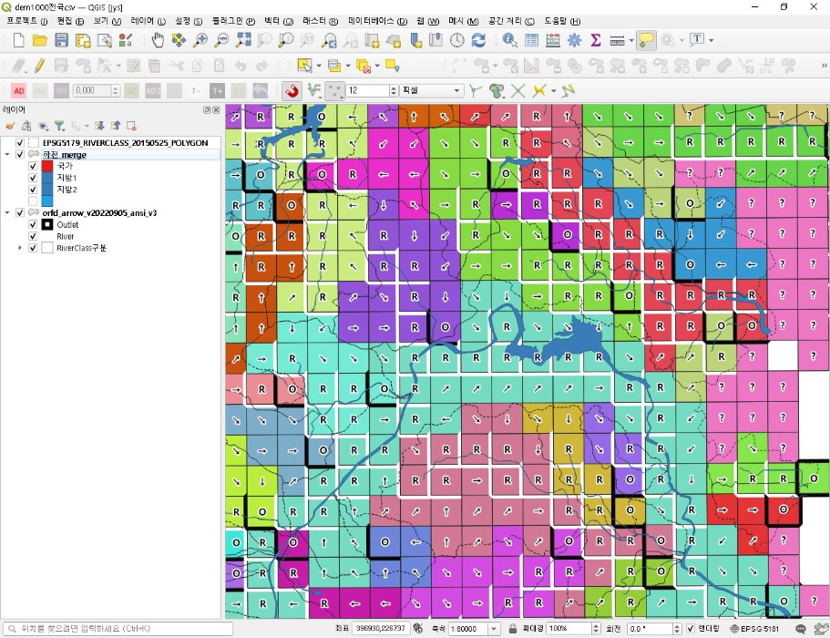
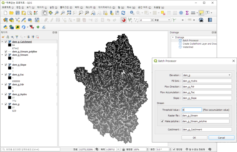 수문지형 처리모듈
$0- $9.19
-
- ~
-
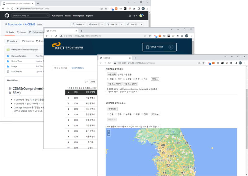 K-FRM을 위한 K-CDMS (치수정량평가DB)
$0- $9.19
-
- ~
-
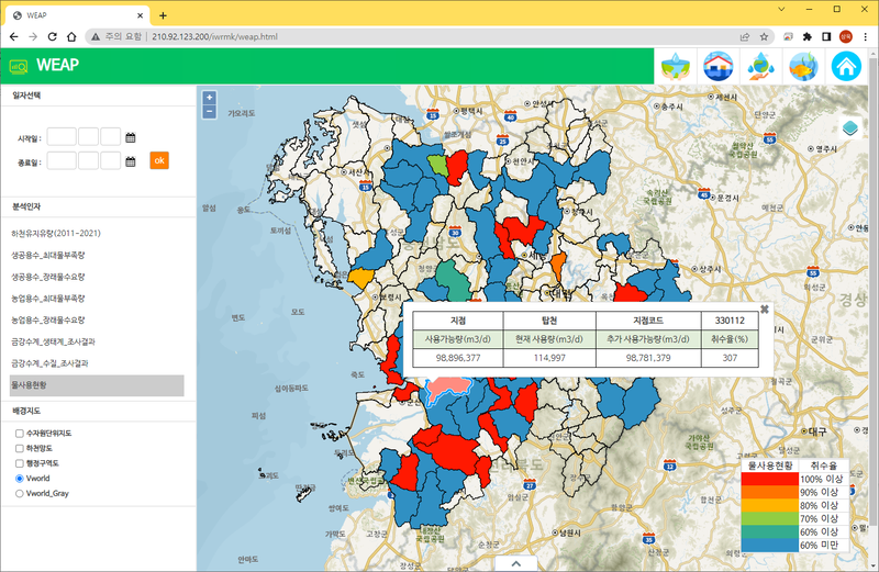 KICT 주관 IWRM-K (이수 KWEAP)
$0- $9.19
-
- ~
-
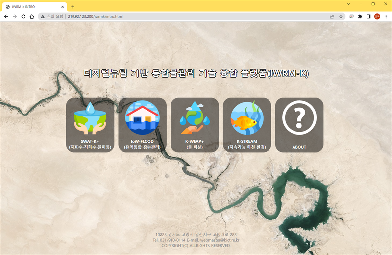 KICT 주관 IWRM-K
$0- $9.19
-
- ~
-
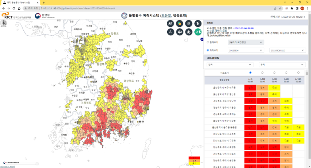 국지 돌발홍수예측 시스템
$0- $9.19
-
- ~
-
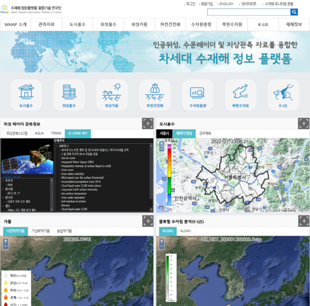 국토관측센서 기반 수문 및 수재해 정보 포털시스템
$0- $9.19
-
- ~
-
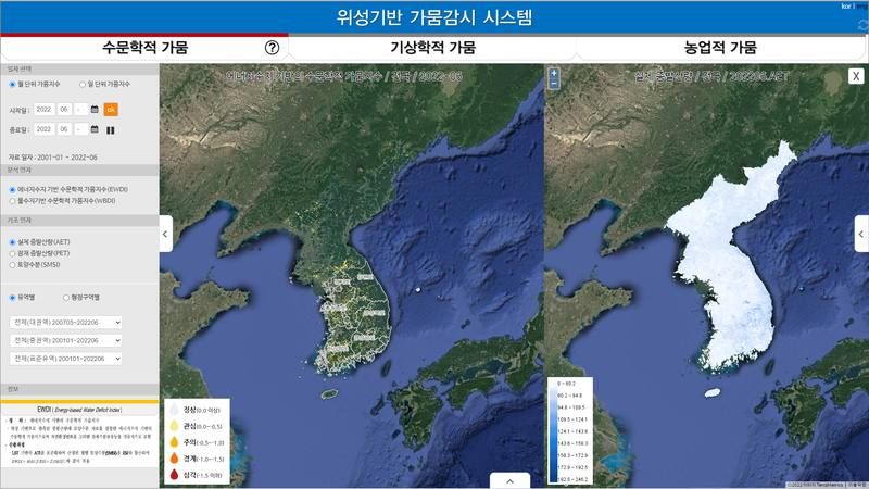 위성기반 가뭄시스템-모니터링
$0- $9.19
-
- ~
-
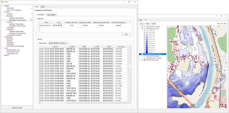 침수 피해 산출 모듈_K-FRM
$0- $9.19
-
- ~
-
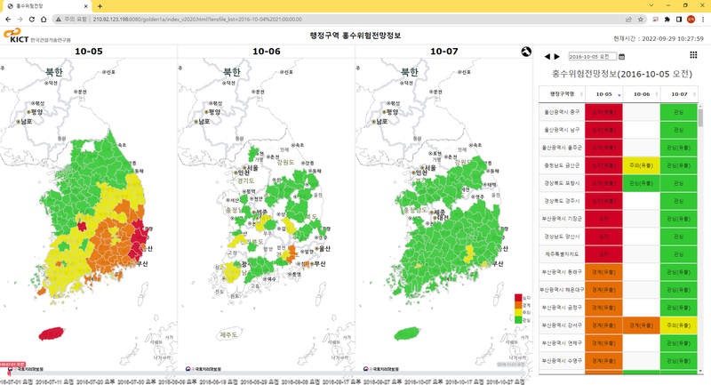 홍수위험전망시스템
$0- $9.19
-
- ~
-
 2022 홍수및침수위험도 Flow System
$0- $9.19
-
- ~
-
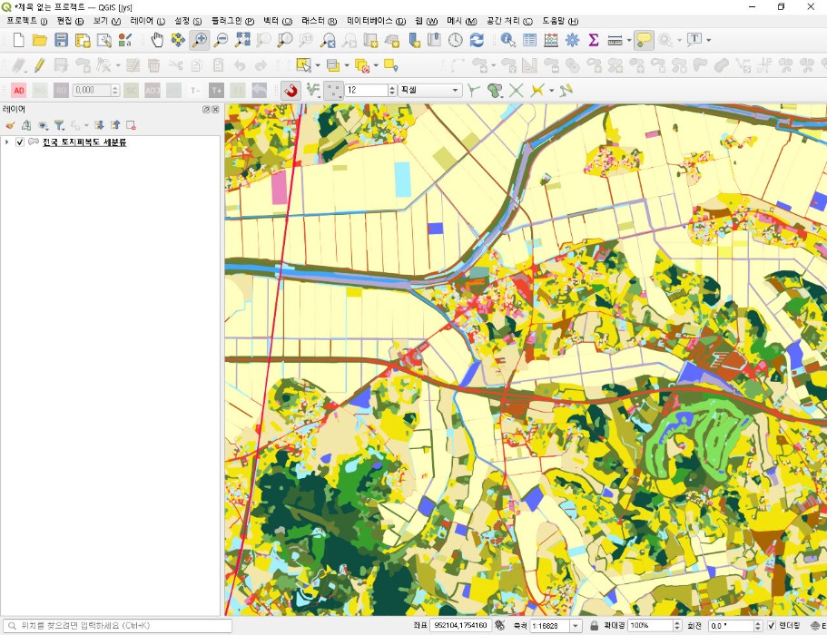 침수위험도의 도시비도시분석에 적용한 환경부 토지피복도 세분류
$0- $9.19
-
- ~
-
 DataMarket
$0- $1.00
-
- ~


