PREVIEW OF HERMESYS SOLUTIONS
Hermesys continues to develop new technologies the GIS market along with the evolution of spatial geographic information technology.
-
Guidance System for Road Name Address(WEB)
-
ITS Communication (Sensor) Information, GIS Processing Technology
-
HermeSys/WMS-Based WEB Commercial Area Analysis System
-
Development of RS Image Data (Layer) Utilization Technology Using OpenAPI
-
HermeSys/WMS-Based Precipitation Frequency utilization system
-
Sewage Register Computerization Out of Yangpyung County's Main Sewerage Area Maintenance Project (Building system and data )
-
Monitoring River and Basin Project - Real-Time Sensing and Comparative Analysis
-
Jungsun County's Water Pipe Network Management System (Building system and data)
-
Monitoring River and Basin Project - Analysis of Landslide Hazard
-
Monitoring River and Basin Project - Soil Loss Analysis
-
KICT's TBM Analysis Application SW Area Consulting (Technical)
-
Jungsun County's Management and Operation Support System of Information on Civil Affairs for Water Pipe Network
-
Mutual Operation and Convergence Processing Technology of Google OpenAPI + User GIS DB
-
KMA's radar rainfall (Universal Format Data) Processing Technology
-
Site Management and Location Guidance System of New Address Data
-
HermeSys Cloud Computing - with the MS Windows Azure Platform
-
Smart GIS Solution that can operate and manage GIS information anytime and anywhere – HermeSys WMS
-
GIS-Based Economic Analysis for Flood Control (Estimation of Water Flooding Rates under the MDF-FDA system)
-
-
Best Path to Travel Web Application
-
Fine dust signal lamp in four colors, using information from the Nearest Sensor
-
WORLD SHIPPING
PLEASE SELECT THE DESTINATION COUNTRY AND LANGUAGE :
닫기


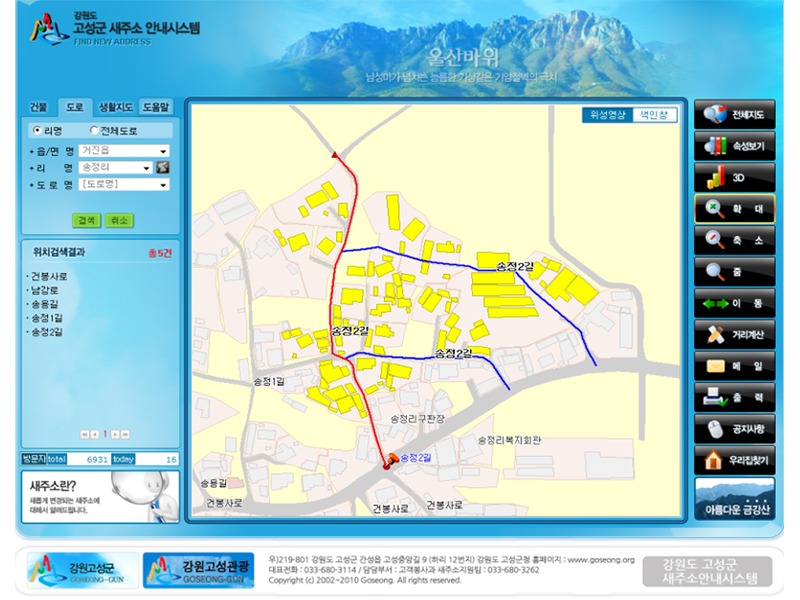 Guidance System for Road Name Address(WEB)
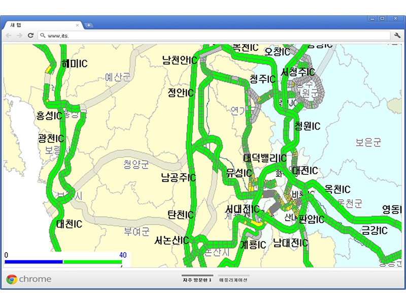 ITS Communication (Sensor) Information, GIS Processing Technology
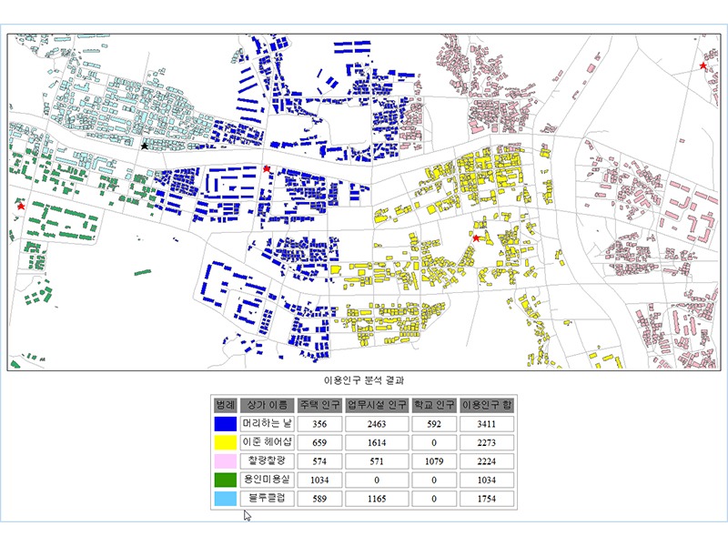 HermeSys/WMS-Based WEB Commercial Area Analysis System
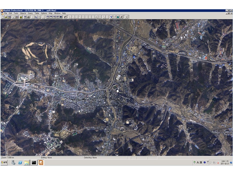 Development of RS Image Data (Layer) Utilization Technology Using OpenAPI
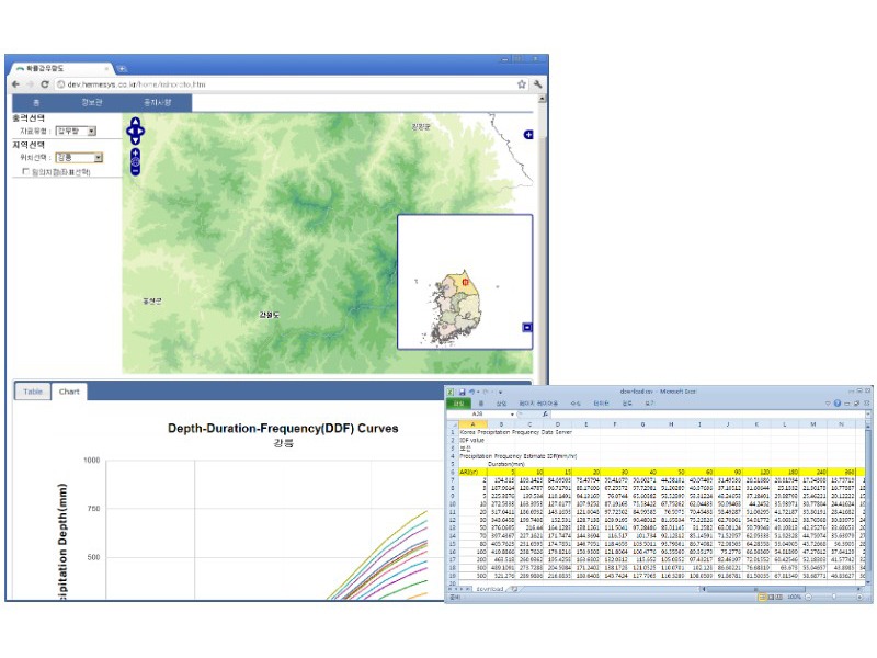 HermeSys/WMS-Based Precipitation Frequency utilization system
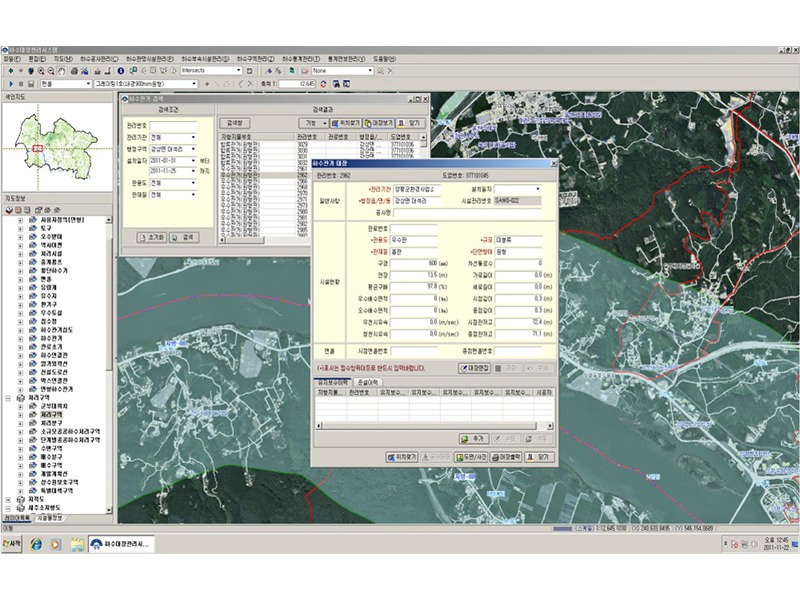 Sewage Register Computerization Out of Yangpyung County's Main Sewerage Area Maintenance Project (Building system and data )
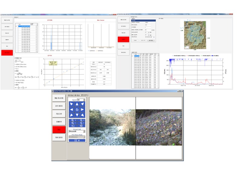 Monitoring River and Basin Project - Real-Time Sensing and Comparative Analysis
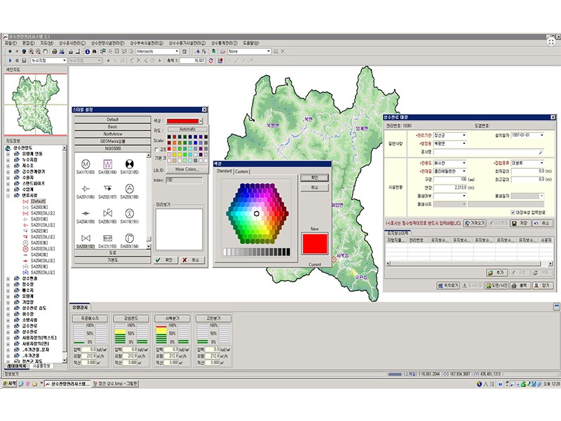 Jungsun County's Water Pipe Network Management System (Building system and data)
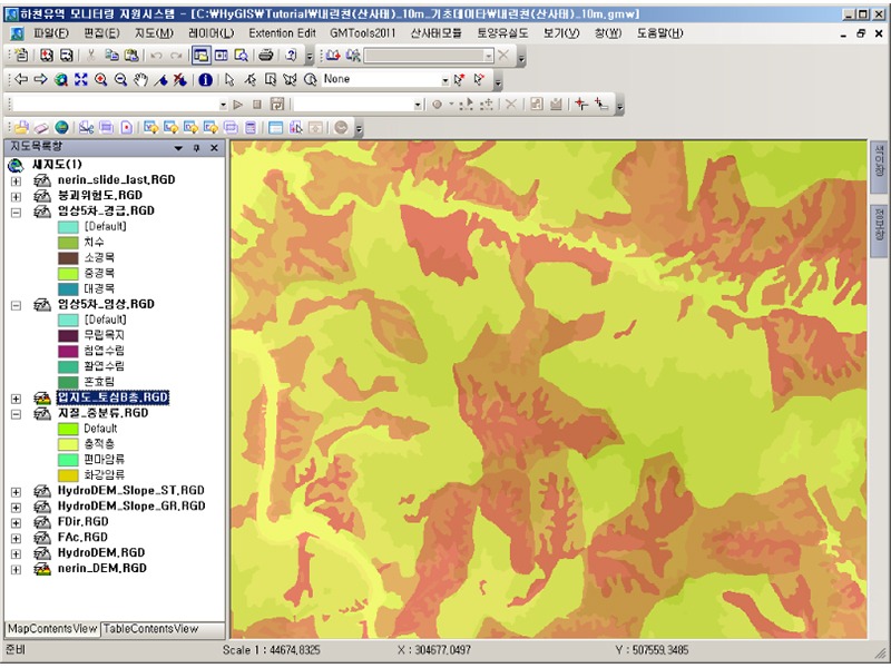 Monitoring River and Basin Project - Analysis of Landslide Hazard
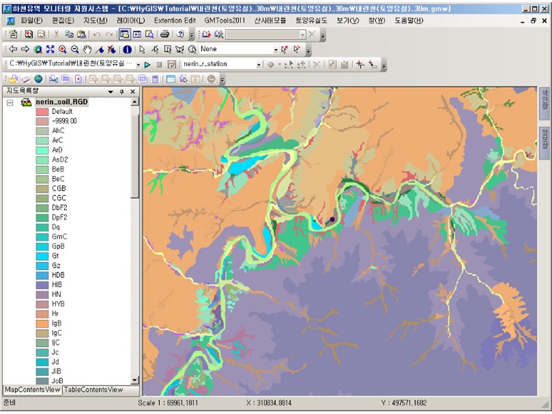 Monitoring River and Basin Project - Soil Loss Analysis
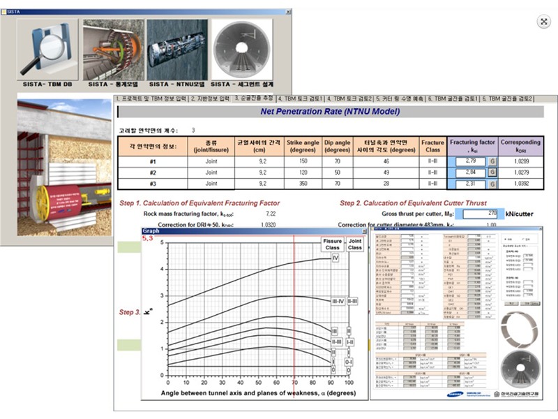 KICT's TBM Analysis Application SW Area Consulting (Technical)
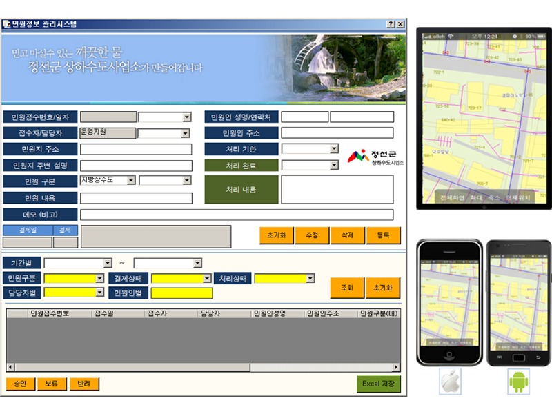 Jungsun County's Management and Operation Support System of Information on Civil Affairs for Water Pipe Network
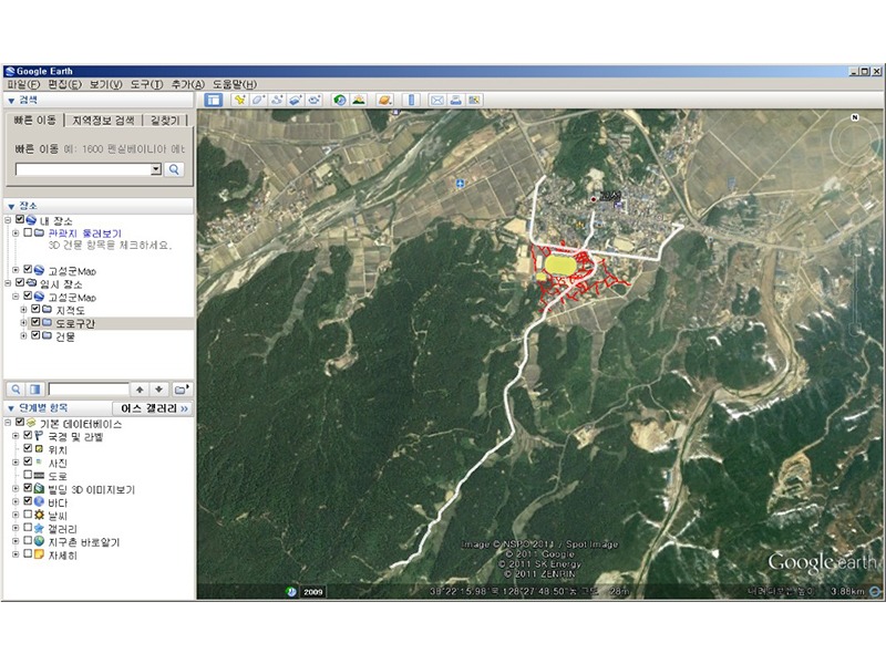 Mutual Operation and Convergence Processing Technology of Google OpenAPI + User GIS DB
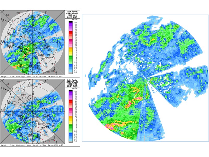 KMA's radar rainfall (Universal Format Data) Processing Technology
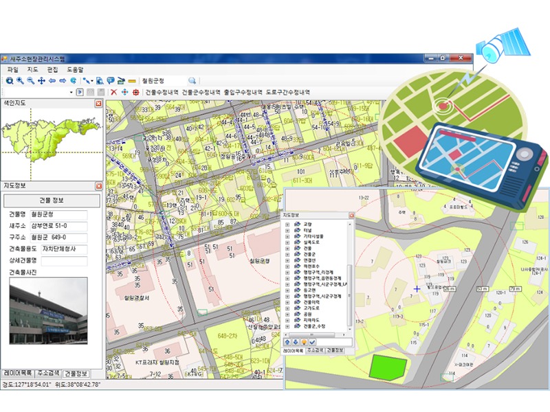 Site Management and Location Guidance System of New Address Data
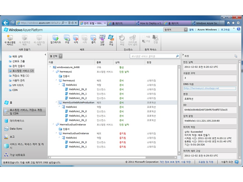 HermeSys Cloud Computing - with the MS Windows Azure Platform
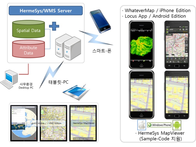 Smart GIS Solution that can operate and manage GIS information anytime and anywhere – HermeSys WMS
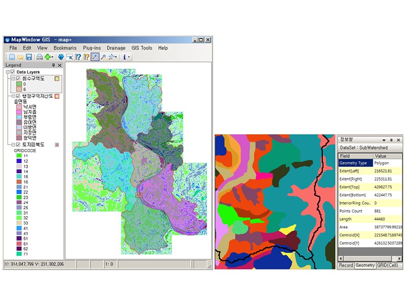 GIS-Based Economic Analysis for Flood Control (Estimation of Water Flooding Rates under the MDF-FDA system)
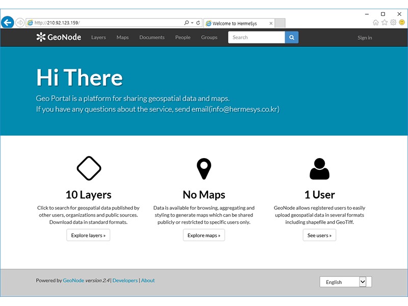 Spatial Portal Site
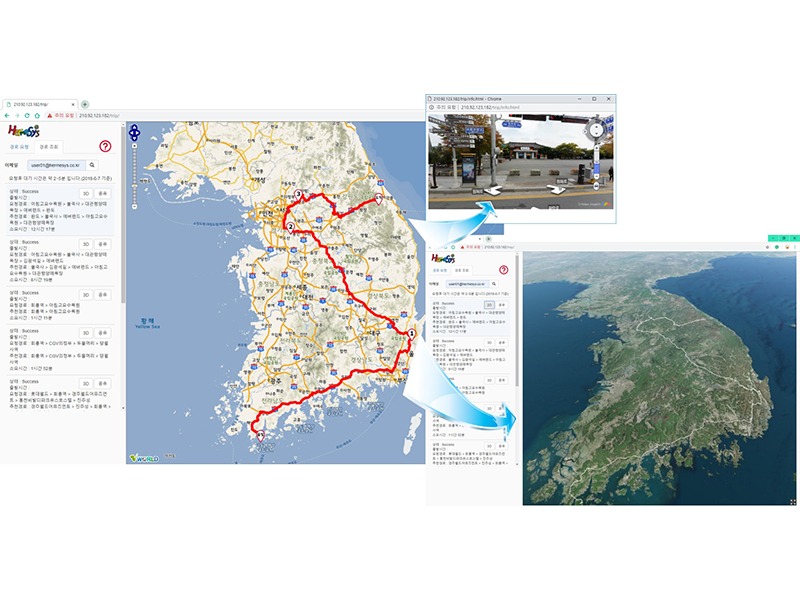 Best Path to Travel Web Application
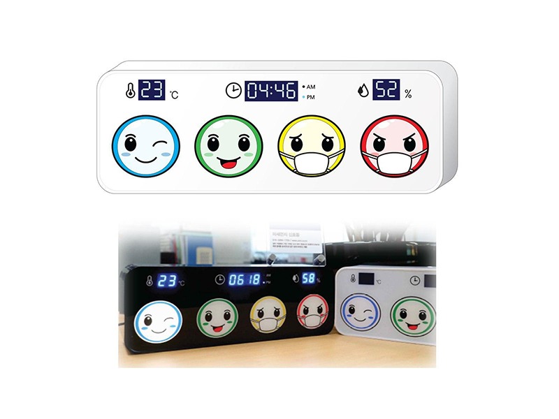 Fine dust signal lamp in four colors, using information from the Nearest Sensor
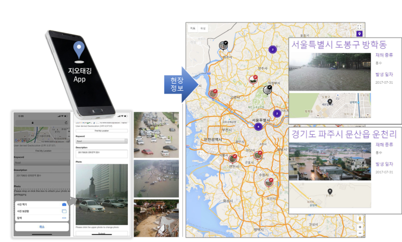 Geotagging System


